

The Causeway Coastal Route: A Local Guide from Belfast to Derry
Written by Murat Yilmaz · Last updated:
Leave Belfast heading north along the shore of Belfast Lough and within half an hour the city is behind you and the road is running between the hills and the sea. That is the start of the Causeway Coastal Route, about 120 miles of signposted road that follows the Antrim coast all the way round to Derry, past castles, glens, harbours, beaches and the Giant’s Causeway itself.
Most of it is the A2. The southern half winds through the Glens of Antrim on a road cut into the foot of the cliffs in the 1830s, and the northern half runs along the top of the Causeway Coast, where the big names sit within a few miles of each other.
The catch is time. On a map it looks like a day’s drive, and you can do it in a day, but not if you want to stop properly. The Giant’s Causeway visitor centre and the Carrick-a-Rede rope bridge both run on timed tickets in season, the car parks at the popular stops fill by late morning in summer, and the road through the Glens is not one to rush.
Below, the route runs in the order you meet it heading north from Belfast, stop by stop, from Carrickfergus Castle to the walls of Derry. Along the way I will tell you where I stop for lunch, where I park at the Dark Hedges, and which stops are worth the time when the day is running short. I drive this road most weeks of the year, so this is the order I would see it in.

What Is in This Guide
- 1Planning the Drive from Belfast to Derry
- 2Carrickfergus Castle
- 3The Gobbins Cliff Path
- 4Glenarm Village and Castle
- 5Carnlough Harbour
- 6Glenariff Forest Park
- 7Cushendall, Cushendun and Torr Head
- 8Ballycastle and Rathlin Island
- 9The Dark Hedges
- 10Carrick-a-Rede Rope Bridge and Ballintoy Harbour
- 11White Park Bay
- 12The Giant’s Causeway
- 13Bushmills Village and the Old Bushmills Distillery
- 14Dunluce Castle
- 15Portrush and Portstewart
- 16Mussenden Temple and Downhill Demesne
- 17Derry, the End of the Route
- 18Seeing the Route Without a Car
- 19The Best Time of Year for the Drive
- 20Tips for Driving the Route
- 21Causeway Coastal Route FAQ
- 22Private Tours in Belfast and Northern Ireland
Planning the Drive from Belfast to Derry
The route runs for about 120 miles between Belfast and Derry, and it is marked all the way with brown tourist signs. Most of it is the A2, with the odd scenic loop off it, such as the narrow road over Torr Head between Cushendun and Ballycastle. The free official route map is published by Visit Causeway Coast and Glens, but on the road you simply follow the brown signs.
You can drive it in a day. It is a long one, eight to ten hours, and you will have to choose between the stops rather than see them all. Two days is far more comfortable, with a night in Ballycastle, Bushmills or Portrush, and three days or more lets you add Rathlin Island, The Gobbins and the walks in the Glens.
If you only have one day and the Giant’s Causeway is the main reason you came, there is no rule that says you must start at Carrickfergus. Many people take the direct road from Belfast, about 60 miles, and then follow the coast back.
The stops below run in the order you meet them heading north. Where we have a full guide to a place, I have linked it at the end of that stop, and that is where you will find the opening times, prices and parking.

Carrickfergus Castle
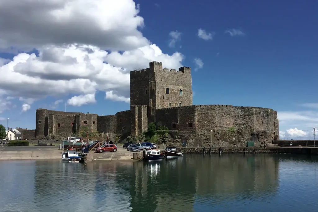
Half an hour out of Belfast along the north shore of the lough, Carrickfergus Castle is the first stop, and one of the best preserved Norman castles in Ireland. John de Courcy began building it in 1177, and it has guarded this harbour for more than 800 years. William of Orange landed here in 1690 on his way to the Battle of the Boyne.
You can see a good deal of it from the seafront and the harbour wall without going in, and that is enough if the day ahead is long. If you do go inside, the keep, the walls and the great hall are worth an hour, and the guided tours are free.
Visitor information
Opening times: Easter to September, 9.30am to 4.30pm, with last admission at 4pm. October to Easter, 9am to 4pm, with last admission at 3.30pm. Closed on Mondays, except bank holidays.
Guide prices: Adult £6, child aged 5 to 17 £4, under fives free, student and over 65 £4.50, and a family ticket for up to five people £18.
Where it is: Marine Highway, Carrickfergus, BT38 7BG, about 30 minutes from Belfast, with free parking.
The Gobbins Cliff Path
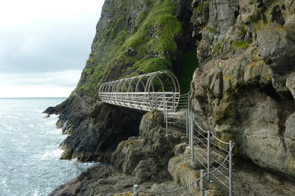
Out on the Islandmagee peninsula, about 40 minutes from Belfast, The Gobbins is a path of steel bridges, tunnels and walkways fixed to the cliff face just above the sea. It first opened to visitors in 1902, fell into ruin, and was rebuilt and reopened in 2015.
It is a guided walk only, about three hours and three miles, and it is harder than it looks. The official comparison is climbing up and down 50 flights of stairs. Walking boots with ankle support are compulsory, everyone wears a hard hat, and nobody under four feet tall can go on the path. Book ahead, because the tours fill.
Plan for it as half a day on its own. If you try to fit The Gobbins and the whole coast into one day, something has to give.
Visitor information
Season: 1 March to the first weekend in January. The visitor centre is open daily from 8.30am to 5pm.
Guide prices: Adult £23.50, child under 16 £17.50, and a family ticket for two adults and up to two children £52.50. Boot hire is £5.
Where it is: The Gobbins Visitor Centre, Middle Road, Islandmagee, BT40 3SL.
Glenarm Village and Castle
Past Larne, the road drops down to the sea, and this is where the coast road proper begins. It was cut along the foot of the cliffs in the 1830s, and from here you are driving between the rock on one side and the water on the other.
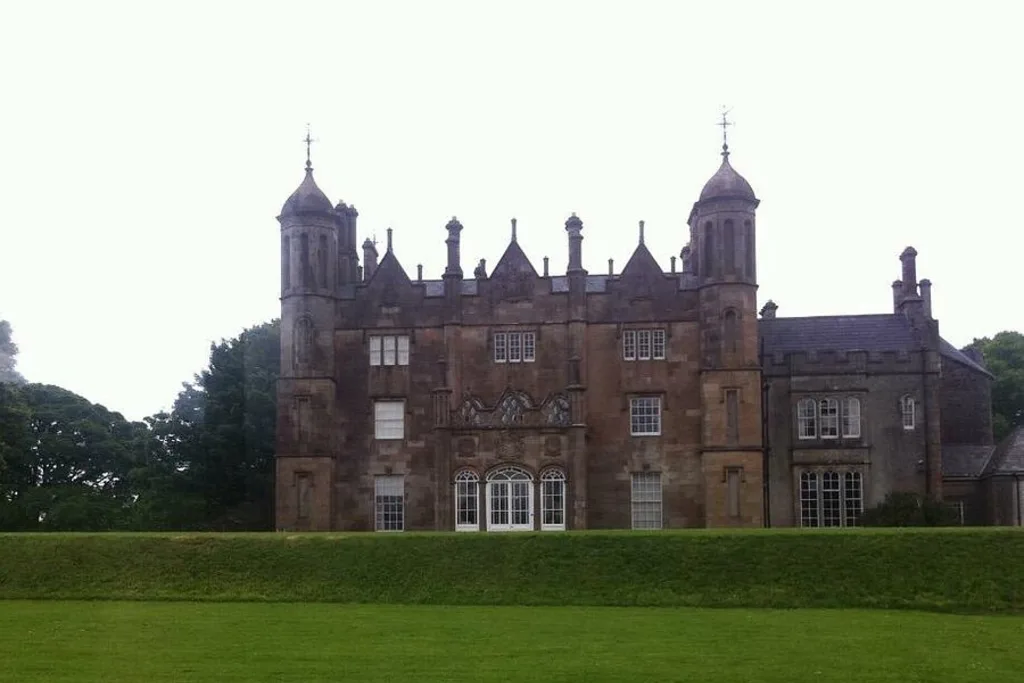
Glenarm is the first village of the Glens, small and quiet, with a river running through it down to the harbour. Glenarm Castle has been the home of the MacDonnell family, the Earls of Antrim, since the 17th century, and its walled garden is what most visitors come to see. It was named Garden of the Year by Historic Houses in 2023, the first garden in Northern Ireland to win it, and the tea room inside the garden is a good place for a coffee.
Visitor information
Opening times: Daily, 10am to 5pm, with last entry at 4:15pm.
Tickets: £10 for adults, £8.50 for over 60s and students, £5 for ages 12 to 17, and free for children under 12. Book online on the castle’s own website or pay on arrival.
Facilities: Tea room, shops and parking on site. Dogs are welcome on a lead in the walled garden and on the woodland walk.
Where it is: 2 Castle Lane, Glenarm, BT44 0BQ.
Carnlough Harbour
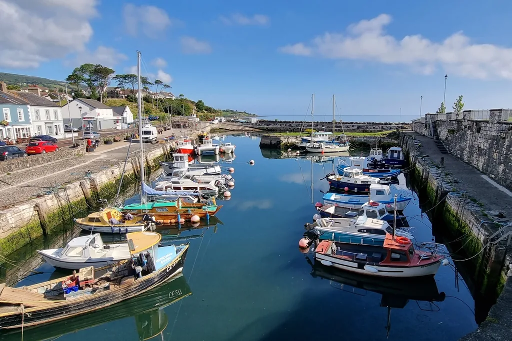
A few miles further on, Carnlough is a small village built around a stone harbour. The harbour was built to ship limestone from the quarries in the hills above, and the stone bridge over the main street once carried the railway that brought it down to the boats.
Game of Thrones fans know it as the harbour where Arya Stark climbed out of the canal in Braavos.
If you are a coffee or tea lover, this is the place to stop. There is a free car park at the harbour and a restroom you can use free, and Twilight Coffee does very nice fresh ground coffee, with scones and things like that. I would suggest it. A walk along the harbour wall afterwards is a good way to stretch your legs before the Glens.
Our Carnlough Harbour guide has the parking and the full Game of Thrones story.
Glenariff Forest Park
At Waterfoot the road meets the mouth of Glenariff, the best known of the nine Glens of Antrim and often called the Queen of the Glens. Turn inland here, and Glenariff Forest Park is about ten minutes up the valley.
The Waterfall Walk is the reason to go. It is a loop of 1.9 miles down into a gorge on steps and timber boardwalk, past one waterfall after another, and then back up again. Allow an hour to an hour and a half, wear shoes with a good grip, and bring a waterproof whatever the forecast says.
If you are short of time, the drive up the glen is worth it on its own, with the valley floor flat and green below you and streams running straight down the cliffs after rain. Our Glenariff Forest Park guide covers the trails, the parking and the opening times.

Cushendall, Cushendun and Torr Head
Cushendall is the next village along, and a good lunch stop on this part of the coast, with pubs and cafés on its main street.
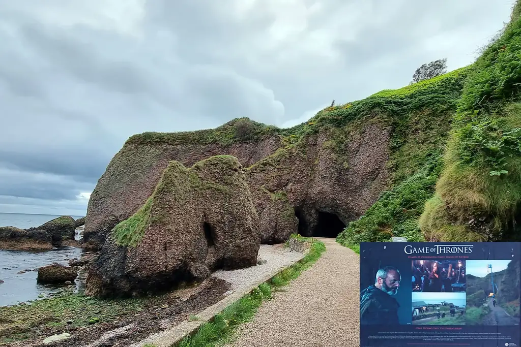
Cushendun, a few miles on, is something different. In 1912 Ronald McNeill, later Lord Cushendun, had the village built to look like a Cornish fishing village to please his wife Maud, who came from Penzance. The architect was Clough Williams-Ellis, and the National Trust has looked after most of the village since 1954. At the end of the beach are the Cushendun caves, where Melisandre gave birth to the shadow in Game of Thrones, and they are free to walk to.
From Cushendun you have a choice. The main road heads inland to Ballycastle. The scenic route goes over Torr Head, about 12 and a half miles of narrow, steep road with sharp bends, and at the top you can see across to the Mull of Kintyre in Scotland, the shortest crossing between the two countries. On a clear day it is one of the finest drives in Northern Ireland. It is not suitable for coaches, caravans or large campervans, and if the mist comes down on the high sections, take the main road instead.
Ballycastle and Rathlin Island
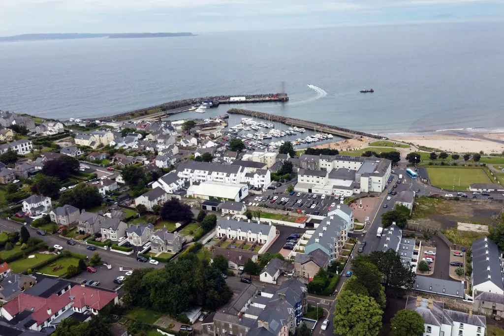
Ballycastle is where the Glens meet the Causeway Coast, a seaside town with a long beach, a harbour and a good choice of places to eat. At the end of August it hosts the Ould Lammas Fair, which has been held in the town since the 17th century.
The ferry to Rathlin Island leaves from Ballycastle harbour. Rathlin is about six miles offshore, and in 1898 Marconi’s company tested wireless messages between the island and the mainland here. The RSPB Seabird Centre at the West Light is the place to see puffins, from late April to early August, but it is four and a half miles from the island harbour, so check the ferry and the island minibus times before you give the day to it.
Visitor information
Rathlin ferry fares: Adult return £16.80 and child return £8.40. Over 65s and children under five travel free.
Booking: Book ahead on the Rathlin Island Ferry website, as space on the boat is limited.
Where it leaves: Ballycastle Harbour. Parking near the ferry terminal is limited, so arrive in good time.
The Dark Hedges
From Ballycastle, I would suggest a short detour inland before you carry on along the coast. The Dark Hedges is an avenue of beech trees on the Bregagh Road near Armoy, about 20 minutes from Ballycastle. The Stuart family planted them in the 18th century to impress visitors arriving at their house, and in Game of Thrones the avenue became the Kingsroad.
The road has been closed to cars since 2017, so you walk it. I have parked in the same spot every time for nine years: the gravel lay-by at the top end of the Bregagh Road, where it meets the Ballykenver Road. It puts you in at the quieter end of the avenue, away from the main car park at the Ballinlea Road end. Early in the morning or late in the evening is the best time, when there are fewer people standing in the middle of the road for photographs.
Our Dark Hedges guide has the history and the parking in full.

Carrick-a-Rede Rope Bridge and Ballintoy Harbour
Back on the coast, five miles west of Ballycastle, the Carrick-a-Rede Rope Bridge hangs about 100 feet above the sea between the cliff and a small island. Salmon fishermen first strung a bridge here more than 250 years ago. Today it is run by the National Trust, crossings are by timed ticket, and it closes when the wind is too strong, so book your slot in advance and allow about an hour and a half.
If you would rather not cross, the walk out along the cliff path to the viewpoint is worth it on its own, with Rathlin Island off the coast and, on a clear day, Scotland on the horizon.
Just past it, the steep, narrow road down to Ballintoy Harbour is worth taking. The little harbour was the Iron Islands in Game of Thrones, and the rocks and sea stacks around it are some of the best on the coast for photographs. Our Carrick-a-Rede guide explains the tickets and the crossing.

White Park Bay
A couple of minutes west of Ballintoy, White Park Bay is a mile and a quarter of sand between two chalk headlands, with hardly a building in sight. It is at its best in summer.
The view from the car park at the top costs nothing and needs no walking, and for most people that is enough. Getting down to the sand means steep steps and a rough path, roughly a mile each way, and there are no facilities on the beach. It is not a swimming beach either, because of the rip currents.
Our White Park Bay guide has the walk down and the history of the bay.

The Giant’s Causeway
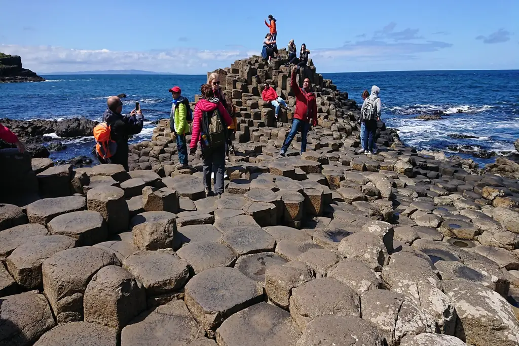
This is the stop most people drove all this way for. Around 40,000 basalt columns step down into the sea, formed by volcanic activity some 60 million years ago, and the Causeway is the only UNESCO World Heritage Site in Northern Ireland.
The stones themselves are free to walk to. What you pay for is the visitor centre and its car park, run by the National Trust. It is far quieter before ten in the morning or after four in the afternoon, and the walk down from the top is about half a mile on a tarmac road, with a shuttle bus if you would rather not walk it.
Our Giant’s Causeway guide explains the tickets, the parking and the free way in properly.
Bushmills Village and the Old Bushmills Distillery
Two miles inland from the Causeway, Bushmills is the village I would choose for lunch on this end of the coast. The Hip Chip on Main Street is the fish and chip shop I use all the time, and there are sandwich shops and cafés around it if you want something lighter. For a proper sit-down meal, the Bushmills Inn is the place, but book a table ahead, because it is popular.
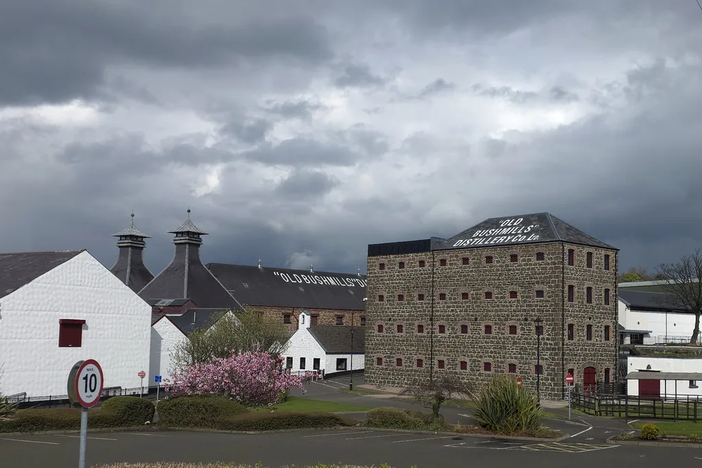
The village is also home to the Old Bushmills Distillery, which makes its whiskey under a licence granted in 1608. If you want the distillery tour, book it in advance. If not, the tasting room is still worth a look.
Dunluce Castle
A few miles west, Dunluce Castle sits on its own rock above the sea, a ruin of the 16th and 17th centuries reached by a narrow bridge from the mainland. It was the seat of the MacDonnells, the Earls of Antrim, and the story goes that in 1639 the kitchen fell into the sea in a storm, taking the cooks with it.
You can see it from the road for nothing, but the best view of all is from the Magheracross viewpoint, a quarter of a mile along the road towards Portrush. That is where the photograph most people are after is taken. Our Dunluce Castle guide has the full history, the kitchen story and the ticket prices.

Portrush and Portstewart
Portrush is the seaside town at the heart of this coast, built on a narrow headland with a long beach on either side. Just before you reach it, the white chalk cliffs at Whiterocks are worth a stop, with arches and caves cut into them by the sea. On the edge of the town is Royal Portrush Golf Club, which hosted The Open in 2019 and again in 2025.
Portstewart, a couple of miles on, is quieter, with a promenade along the sea front. Just outside it, Portstewart Strand is nearly two miles of sand backed by some of the tallest dunes in Ireland, looked after by the National Trust. In season you can drive onto the beach and park on the sand itself, for a charge.

Mussenden Temple and Downhill Demesne
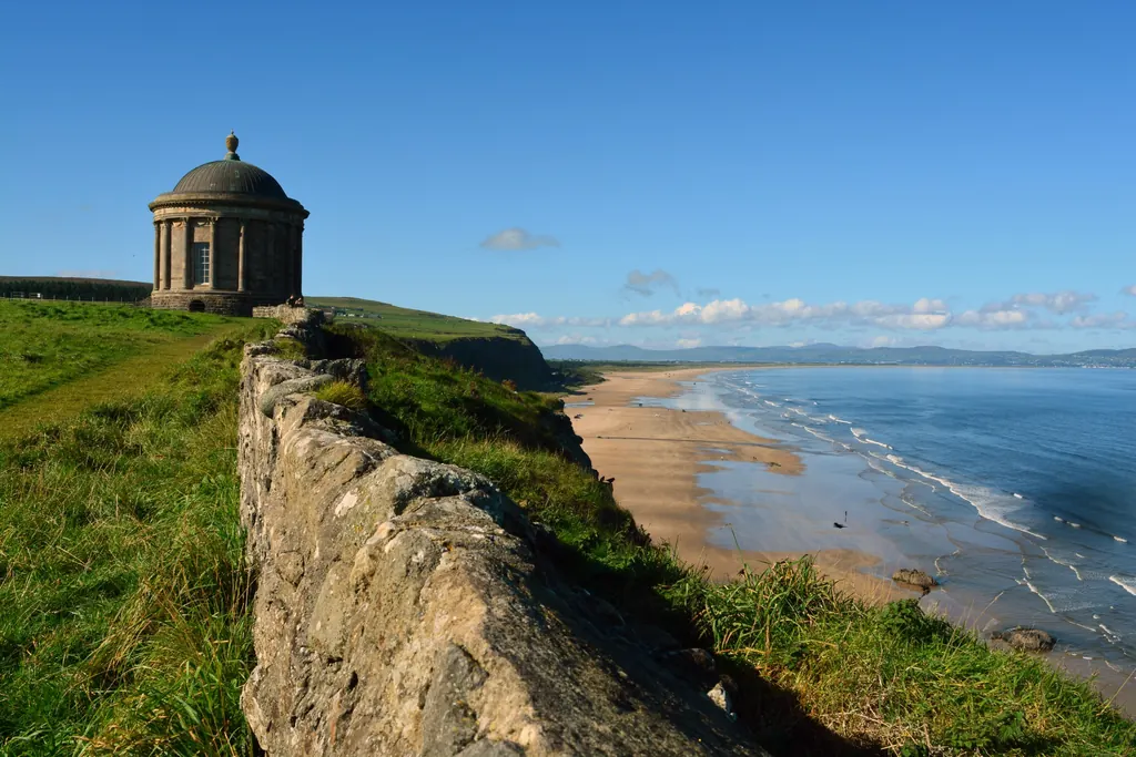
Past Coleraine and Castlerock, Mussenden Temple stands right on the cliff edge above Downhill Strand. The Earl Bishop finished it in 1785 as a library, and the roofless walls of his house and the gardens of the Downhill estate are all around it.
The grounds are free to walk, with a parking charge for anyone who is not a National Trust member, and the beach below was Dragonstone in Game of Thrones. Our Mussenden Temple guide covers the history, the gardens and the parking.
Derry, the End of the Route
The route ends in Derry, the walled city on the River Foyle, which you will also see signed as Londonderry. Its 17th century walls are the only complete city walls in Ireland, and you can walk the full circuit of about a mile on top of them. It takes under an hour and gives you the whole city from above.
The Peace Bridge, opened in 2011, carries you across the Foyle from the city centre, and it is a pleasant walk at the end of a long day in the car.
For dinner, Browns in Town on Strand Road is the restaurant I would suggest. It is a short walk from the walls, the food is local and seasonal, and it is worth booking ahead. Our guide to things to do in Derry covers the rest of the city.

Seeing the Route Without a Car
You can see parts of the route by public transport, but not all of it in one day. Trains run from Belfast Grand Central to Coleraine roughly every hour, about an hour and twenty minutes, and the line carries on to Castlerock and Derry. From Coleraine, buses run along the coast past Portrush, Dunluce Castle and Bushmills to the Giant’s Causeway, and some coastal services are seasonal, so check Translink before you travel.
The Glens of Antrim, Torr Head and the Dark Hedges are much harder to reach without a car. For anyone not driving, a private tour is the straightforward way to see the route in a day, and our Giant’s Causeway tour from Belfast follows it.
The Best Time of Year for the Drive
Spring and summer give you the long days, and in June it is light until well after ten at night, which makes a one day trip far easier. They also bring the crowds, and July and August are when the car parks fill earliest.
September and October are my favourite months on this road. The light is softer, the coach traffic eases off, and most of the attractions are still on their summer hours.
Winter is quiet and atmospheric, but the days are short, some attractions shorten their hours or close, and Carrick-a-Rede and the coast road can both be shut by bad weather.
Tips for Driving the Route
Book what needs booking. Carrick-a-Rede and The Gobbins both need tickets in advance, and the Giant’s Causeway visitor centre runs on timed tickets in season.
Start early. The Giant’s Causeway and Carrick-a-Rede are both at their busiest from late morning to mid afternoon, so plan to reach one of them first thing.
Take your time on the road through the Glens. It is narrow in places, it follows every curve of the coast, and it is shared with cyclists, tractors and coaches. Drive on the left, and use the lay-bys to let faster traffic past rather than racing to the next stop.
Wear proper shoes. Almost every stop on this route involves a walk on uneven ground, and the path down at the Giant’s Causeway, the boardwalk at Glenariff and the steps at White Park Bay are all slippery when wet.
Bring a waterproof, whatever the forecast says. The weather on the north coast changes by the hour.
Causeway Coastal Route FAQ
Where does the Causeway Coastal Route start and finish?
It runs between Belfast and Derry, following the Antrim coast round the north of Northern Ireland. You can drive it in either direction.
How long is the Causeway Coastal Route?
About 120 miles if you follow the coast the whole way from Belfast to Derry. It is signposted with brown tourist signs and mostly follows the A2.
How long does it take to drive the Causeway Coastal Route?
Without stopping, around four hours. With stops, plan on a full day just for Belfast to the Giant’s Causeway, and two or three days to do the whole route properly.
Can you do the Causeway Coastal Route in one day?
You can see the highlights between Belfast and the Giant’s Causeway in one long day of eight to ten hours. You will need to choose your stops, as there is not time for all of them.
What are the best stops on the Causeway Coastal Route?
The Giant’s Causeway, Carrick-a-Rede, Dunluce Castle, Glenariff, Carnlough, Ballintoy Harbour and Bushmills, with the Dark Hedges as a short inland detour.
What is a good Causeway Coastal Route itinerary for one day?
Belfast, Carnlough, the Glens, Ballycastle, Carrick-a-Rede, the Giant’s Causeway, lunch in Bushmills and Dunluce Castle, then back to Belfast on the direct road through Ballymena.
Is the Causeway Coastal Route from Belfast easy to drive?
It is a good road, but narrow and winding in places, especially through the Glens and over Torr Head. Drive on the left, take your time and use the lay-bys.
Can you do the Causeway Coastal Route by train?
Partly. The train runs from Belfast to Coleraine and on to Derry, and buses run from Coleraine to Portrush, Bushmills and the Giant’s Causeway. The Glens are hard to reach without a car.
Is the Dark Hedges on the Causeway Coastal Route?
Not directly. It is about 20 minutes inland from Ballycastle or the Giant’s Causeway, and makes an easy detour between the two.
Do you need to book anything on the Causeway Coastal Route?
Carrick-a-Rede and The Gobbins need tickets booked in advance, and the Giant’s Causeway visitor centre runs on timed tickets in season. The rest of the route is free to drive.
When is the best time to drive the Causeway Coastal Route?
May to October for the long days and the attractions on summer hours. September and October are quieter than high summer and often have the best light.
Where should you stay on the Causeway Coastal Route?
Ballycastle, Bushmills and Portrush are the most convenient bases, right in the middle of the busiest stretch of the coast.
Is there a Causeway Coastal Route map?
Yes, the route is signposted the whole way, and the local tourism office publishes a free downloadable map. On the road, follow the brown Causeway Coastal Route signs.
Follow Us for Tour Updates & Travel Inspiration
Follow us for travel inspiration, local insights, and real moments from our private tours across Northern Ireland. Stay updated with new experiences, seasonal highlights, and guest stories.
Private Tours in Belfast and Northern Ireland
Belfast Tours NI offers private, chauffeur-led tours and bespoke day trips throughout Northern Ireland and Ireland. From exploring Belfast’s historic streets to visiting the Giant’s Causeway or enjoying a relaxed shore excursion from Belfast Cruise Terminal, every journey is planned around you.
Our service combines comfort, local knowledge, and personal attention. Your chauffeur is not just a driver, but a local expert who adds depth to your experience with insight, stories, and carefully chosen routes that showcase the best of each destination.
We work closely with leading hotels and accommodation partners to ensure a seamless, high-quality experience from start to finish. Attention to detail, punctuality, and discretion are central to every tour we provide.
As a trusted private tour provider in Belfast, we design personalised itineraries based on your interests, whether that means coastal scenery, historic castles, cultural landmarks, or iconic filming locations. Whether visiting for leisure or arriving by cruise ship, Belfast Tours NI offers a refined, stress-free way to experience Ireland at its best.
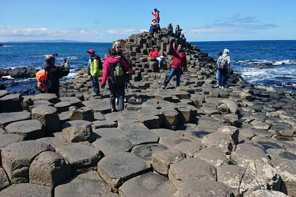
Giants Causeway Tour
A full day at the Giant’s Causeway from Belfast, travelling the Causeway Coastal Route with your own local driver-guide and time for photos at every stop.

Game of Thrones Tour
Visit the real Game of Thrones filming locations across Northern Ireland, including the Dark Hedges and Ballintoy Harbour, on a fully private tour.
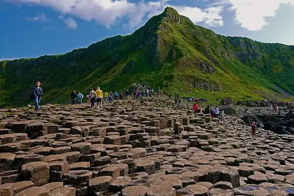
Giant’s Causeway Half Day Tour
Short on time? A private half-day run to the Giant’s Causeway and the Antrim Coast, ideal if your day in Belfast is already busy.
Planning a private tour of Northern Ireland? ➔ Get in touch to discuss your ideas.
Connect with Us
We drive the Causeway Coastal Route most weeks of the year, and we post what we see. Which car parks fill first, when the light is best at the Causeway, which stops are worth the time in each season, and the places worth an hour when an hour is all you have.
If you are planning a trip along the coast and want to ask something, a message on any of the channels below is the quickest way to reach us. We are happy to answer questions about the route, where to stay, what to book ahead or anything else you are trying to fit into your days here, whether or not you end up booking a tour with us.
Follow along for new photographs, short videos from the road, and a note when opening times or prices change at the places people ask about most.
Facebook
Pinterest
LinkedIn
WhatsApp