

Portballintrae and Portbraddan, Two Quiet Causeway Coast Villages
Written by Murat Yilmaz · Last updated:
Leave the coach traffic on the main road, drop down into Portballintrae and you are standing beside a small harbour, a curve of bay and the start of a path that runs to the Giant’s Causeway without touching a road. Portballintrae is a seaside village of about 500 people, two miles west of the Causeway and four miles east of Portrush. Further east along the coast, at the far end of White Park Bay, Portbraddan is smaller still, a short row of cottages under the cliff that you reach on foot.
Both places grew out of the sea. Portbraddan takes its name from the Irish for ‘port of the salmon’, and its fishing station worked into this century. Portballintrae looks out over the water where the Armada ship Girona was wrecked in 1588, and much of the land around it has belonged to the Macnaghten family of Runkerry House and Dundarave for generations.
There is a catch with each of them. Runkerry Beach looks perfect for a swim, but the council advises against bathing there because of rip currents, and there is no lifeguard. Portbraddan has no public car access, and the National Trust warns of rockfall on the stretch between White Park Bay and the hamlet, so the tide decides when you can walk in.
I am on this coast most weeks of the year, and these are two of the places I would point you to when the big stops are busy. Below I cover the village and harbour at Portballintrae, Runkerry Beach and Runkerry House, the off road walk to the Causeway along the Causeway Coast Way, the story of the Girona, and how to reach Portbraddan safely. Each place has its own visitor information, with parking, toilets and how to get there.
What Is in This Guide
- 1Portballintrae Village and Harbour, a Quiet Base Near the Causeway
- 2Runkerry Beach, the Long Strand Between Portballintrae and the Causeway
- 3Runkerry House, the Sandstone Mansion Above the Strand
- 4The Portballintrae to Giant’s Causeway Walk on the Causeway Coast Way
- 5The Girona Wreck, Spanish Armada Gold off the Causeway Coast
Portballintrae Village and Harbour, a Quiet Base Near the Causeway
Portballintrae sits on a sheltered bay just off the coast road between Portrush and Bushmills. The road into the village runs round the back of the bay, past the harbour and the small sandy cove known as Salmon Rock Beach, and on to the larger car park above Runkerry Beach. It is a quiet, residential place for most of the year, with holiday homes, a hotel, a golf club and a boat club, and it gets busier in summer when families come for the water.
The Portballintrae harbour is small and still used by local boats. In summer you will see dinghies and paddleboards in the bay, and on a calm morning it is one of the most peaceful spots on the Causeway Coast. Salmon Rock Beach, right in the village, is a compact stretch of sand with rocks at both ends. You reach it by steps at the western end or a gentle sloped path at the eastern end, and there are picnic spots beside it.
Why Portballintrae is worth a stop
The real value of Portballintrae is practical. It has free parking, public toilets and a shop, and it sits two miles from the Giant’s Causeway, which is the busiest and most tightly managed site on this coast. If you want to walk to the stones rather than drive, or you simply want somewhere quiet to stop before or after the Giant’s Causeway, this is the obvious place to start.
The village is also a handy base. The Old Bushmills Distillery is a short drive inland, Dunluce Castle is on the cliffs to the west, and Portrush is four miles away. Just outside the village are the Lissanduff Earthworks, a State Care monument of concentric earthen banks. They are worth a look if you like your history old and quiet.
Toilets, swimming and dogs in Portballintrae
The toilets in the harbour car park close for the winter, while the ones at the beach car park stay open all year with shorter hours. Swimming is not encouraged at Salmon Rock Beach, and there is no lifeguard in the village. Dog restrictions apply on the beaches from 1 June to 15 September.
Visitor information
Opening times. The village, harbour and beaches are open access all year. Beach car park toilets are open 8am to 9pm in July and August, and 8am to 6pm from September to June. Harbour car park toilets are open 8am to 6pm from April to June and 8am to 9pm in July and August, and are closed from September to March.
Guide prices. Free. Parking in the village car parks is free.
Booking. No booking needed.
Facilities. Free parking with disabled spaces, public toilets with disabled access (RADAR key), a shop and picnic areas. There is no lifeguard. Dog restrictions apply on the beaches from 1 June to 15 September.
Where it is. Beach Road, Portballintrae, County Antrim, BT57 8RT. The village is just off the coast road between Portrush and Bushmills, four miles east of Portrush and two miles west of the Giant’s Causeway. From Belfast it is about 60 miles by the M2 and A26, so allow around an hour and a half. The seasonal 402 Causeway Rambler bus stops in the village.
What is nearby. The Giant’s Causeway, Runkerry Beach, the Old Bushmills Distillery and Dunluce Castle.
Runkerry Beach, the Long Strand Between Portballintrae and the Causeway
From the car park at the end of Beach Road, the land opens out onto Runkerry Beach, which locals also call Bushfoot Strand. It runs east from the mouth of the River Bush towards Runkerry House and the Giant’s Causeway, a wide sweep of sand backed by dunes. On a clear day you can see the dark headlands of the Causeway beyond it, and it is a fine place for a long walk with the wind behind you.
The beach is a geological Area of Special Scientific Interest, which tells you this is not just a pretty strand. The River Bush that meets the sea here runs for over 33 miles from the Antrim Hills and has long been a salmon river. You cross it near the start of the walk on the Three Quarter Mile Bridge, a footbridge from the car park, before the path turns along the riverbank on a wooden boardwalk.
Why you should not swim at Runkerry Beach
Runkerry Beach looks inviting, and surfers do use it, but the council is very clear. The beach is noted for strong rip currents and shelving, and bathing is inadvisable. There is no lifeguard service. The nearest lifeguarded beach is Whiterocks, about 3.5 miles west towards Portrush, and lifeguards there are seasonal.
Paddling at the edge on a calm day is one thing, but please do not treat this as a swimming beach. If you want to get in the water, Whiterocks is the better choice in summer, and the rest of the time I would suggest enjoying Runkerry from the sand.
Dogs, parking and toilets at Runkerry Beach
Dogs are allowed on Runkerry Beach, with restrictions from 1 June to 15 September. The beach is open and exposed, so bring a warm layer even in summer. Parking and toilets are in the village car park on Beach Road, where the walk to the Causeway also begins.
Visitor information
Opening times. Open access all year.
Guide prices. Free. Parking in the Portballintrae car park is free.
Booking. No booking needed.
Facilities. Free parking, disabled parking and toilets with disabled access in the main Portballintrae car park. No lifeguard. Bathing is inadvisable because of rip currents and shelving. Dog restrictions apply from 1 June to 15 September.
Where it is. East of Portballintrae village, reached on foot from the car park on Beach Road, Portballintrae, BT57 8RT, over the Three Quarter Mile footbridge. The village is off the coast road between Portrush and Bushmills.
What is nearby. Portballintrae harbour, Runkerry House, the Giant’s Causeway and Whiterocks Beach.
Runkerry House, the Sandstone Mansion Above the Strand
As you walk along Runkerry Beach, one building dominates the headland ahead of you. Runkerry House is a large sandstone mansion built in the early 1860s as part of the Macnaghten estates, and you cannot miss it from the beach. It stands on its own above the dunes, with the sea on one side and the Causeway headlands beyond it.
The house was the home of Lord Macnaghten, and the Macnaghten family still own much of the land around Portballintrae, including Dundarave House near Bushmills. In 1951 Runkerry House was given to the Northern Ireland Government for public use. It has since been refurbished and divided into private apartments, which is what it is used for today.
Can you visit Runkerry House?
No. Runkerry House is now private homes, so there is no public access to the building or its grounds. You get the best view of it from the beach, or from the path that runs in front of it on the circular walk between Portballintrae and the Causeway. Please keep to the marked paths here, because the cliffs around the Runkerry headland are unprotected.
For a photograph, I would suggest walking a little way along the strand from the river and looking back towards the house with the beach in front of it. In the late afternoon the light on the sandstone is at its warmest. Keep to the sand or the path when you do, because the house and its grounds are private.
The Giant’s Causeway and Bushmills Railway below the dunes
Between the house and the village, the path runs alongside the narrow gauge Giant’s Causeway and Bushmills Railway. The line is about two miles long and follows the route of the old electric tramway, which ran from the 1880s until 1949 and was described at its opening as the first long electric tramway in the world. You cross the track twice on the walk, so watch and listen for a train on running days.
The Portballintrae to Giant’s Causeway Walk on the Causeway Coast Way
This walk is the main reason I would suggest a stop in Portballintrae. Section three of the Causeway Coast Way runs 2.7 miles from Portballintrae to the Giant’s Causeway, and it is entirely off road. You leave the car at the free car park on Beach Road and arrive at the visitor centre on foot, walking up onto its grass roof at the end.
The route from Portballintrae to the Giant’s Causeway
From the car park, a gravel path drops downhill and crosses the footbridge over the River Bush. Turn right onto the wooden boardwalk along the riverbank, then follow the path through a wide system of sand dunes beside the railway track, crossing the line twice. The path then climbs onto the cliff tops at Runkerry Head, where the views open out along the coast towards the Causeway, before it reaches the visitor centre.
The council grades the walk as medium, and the surfaces vary between gravel, boardwalk, sand, cliff top and steps. They can be muddy and slippery after rain, so proper walking shoes are worth it. There are unprotected cliff edges around the Runkerry headland, and dogs must be on a lead on the Causeway headland.
The Portballintrae Causeway Loop, a circular walk
If you have a few hours, the Portballintrae Causeway Loop makes a circle of it. It is 5.5 miles and graded moderate, starting and finishing at the car park at the end of Beach Road. It goes over the Three Quarter Mile Bridge, along Runkerry Beach and past Runkerry House, up to the visitor centre and down to the stones. You come back by the Shepherd’s Path and the railway path through the dunes.
Before you set out, check the current Causeway Coast Way trail notices, which list any diversions or works on the route. The Causeway coastline is open from dawn to dusk, and the visitor centre is a separate, paid experience. I have covered the choices in my guide to the Giant’s Causeway.
Walking on from the Causeway to Dunseverick
The Causeway Coast Way carries on beyond the Causeway. Section four, the North Antrim Cliff Path, runs about 4.5 miles from the Causeway to Dunseverick Castle along some of the highest cliffs on the route. From Portballintrae to Dunseverick is therefore around 7.2 miles of coastal walking, which is a full day with the stops.
The Girona Wreck, Spanish Armada Gold off the Causeway Coast
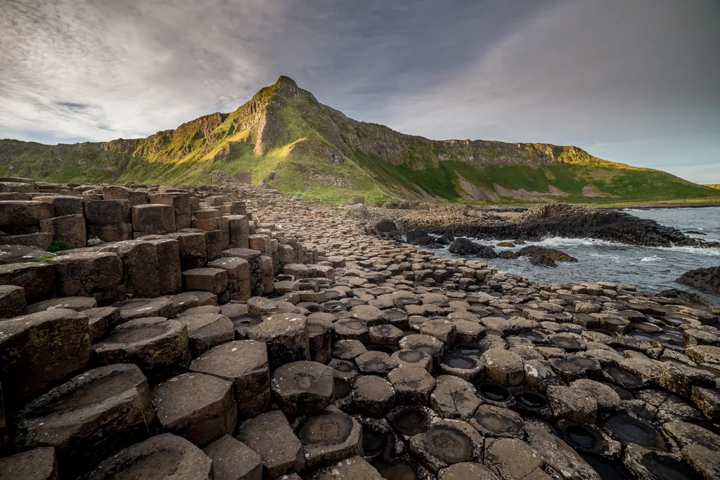
Stand on the cliffs east of Portballintrae and you are looking at the scene of one of the worst disasters of the Spanish Armada. In October 1588 the galleass Girona left Killybegs in Donegal after repairs and tried to reach Scotland. Bad weather drove her onto the rocks at Lacada Point, just beyond the Giant’s Causeway, on the night of 26 October.
Around 1,300 men were on board, and only nine are recorded as surviving. Among those lost was Alonso Martínez de Leiva, one of the Armada’s senior commanders. The council records that around 260 bodies were recovered and buried in the grounds of St Cuthbert’s Church. The bay beside the wreck site is still called Port na Spaniagh, the port of the Spaniards.
The Girona treasure in the Ulster Museum
For almost four centuries the Girona lay where she fell. Then, in 1967 and 1968, a team of divers including the Belgian Robert Sténuit, working with local historian John MacLennan, found the wreck and raised what was then the greatest find of Spanish Armada treasure ever recovered. It included gold and silver coins, jewellery, cannon and personal possessions.
The best known piece is a small gold salamander set with rubies, a creature believed to survive fire and worn as a charm for protection. There is also a gold cross thought to have belonged to the ship’s captain, Hugo de Moncada. The whole collection is in the Ulster Museum in Belfast, and if you are interested in this story it is well worth seeing before or after a day on the coast. It fits easily into a day in the city, and my guide to things to do in Belfast has more ideas.
Where to see the Girona wreck site
The wreck itself is underwater and has been protected under the Protection of Wrecks Act since 1993, so there is nothing to see of the ship. You can, however, look down into Port na Spaniagh from the North Antrim Cliff Path, east of the Causeway. Standing above those rocks with the story in your head makes the wreck feel very close, and the walk from Portballintrae brings you most of the way there.
Portbraddan, the Salmon Fishing Hamlet at the End of White Park Bay
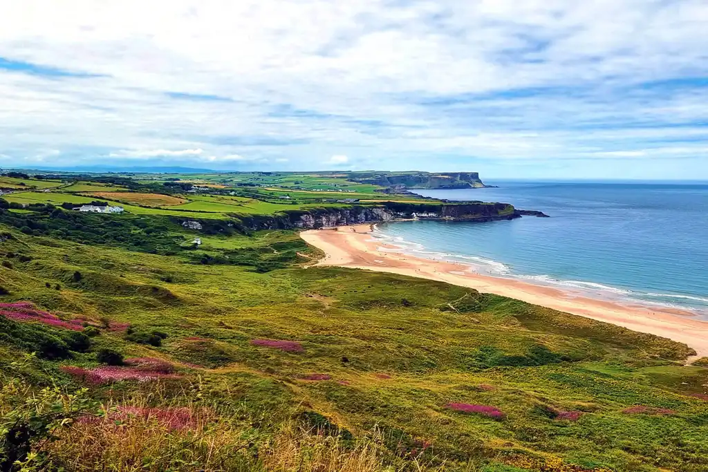
Walk to the western end of White Park Bay and the beach runs out against the cliffs. Tucked at the bottom of them is Portbraddan, also spelt Portbradden, a short row of cottages that is about as small as a settlement can be. The name comes from the Irish Port Bradán, the port of the salmon, and the cottages grew up around a salmon fishing station that was still working until 2001.
There is very little here in the way of things to do, and that is the appeal. You have the cottages, the rocks and the sea, with views across to the western cliffs of Rathlin Island. The National Trust owns one of the cottages, Portbraddan Cottage, which is let as a holiday home. Apart from that, this is a place where people live, so please be considerate of the residents when you visit.
St Gobban’s Church, which is no longer there
For years Portbraddan was famous for St Gobban’s Church, described in guidebooks and walking leaflets as the smallest church in Ireland. It measured just 11 feet 4 inches by 6 feet 9 inches, and it was a popular spot for photographs and even weddings. It was never consecrated as a church, and it was never a listed building.
The building was demolished in 2017 after it was sold, which caused a lot of upset locally. You will still see it described in older guides and on some websites, so I mention it here so you are not disappointed. If you come to Portbraddan, come for the setting and the quiet rather than the church.
Getting into Portbraddan, with no car access
There is no public car access to Portbraddan. The National Trust says vehicle access is only for residents of the hamlet and people staying in the cottage, and there are no facilities of any kind. The usual way in is on foot along the beach from White Park Bay, which needs a low tide.
Visitor information
Opening times. Open access, but you can only cross the beach from White Park Bay safely at low tide. White Park Bay is open dawn to dusk.
Guide prices. Free. The National Trust car park at White Park Bay is free.
Booking. No booking needed to visit. Portbraddan Cottage is a National Trust holiday let and is booked through the National Trust.
Facilities. None. There are no toilets at Portbraddan or at White Park Bay. The nearest public toilets are at Ballintoy, and at Dunseverick Harbour, which are open 24 hours.
Where it is. At the western end of White Park Bay, below the A2 Whitepark Road between Bushmills and Ballintoy. Park at the National Trust car park, 157 Whitepark Road, Ballintoy, BT54 6NH, and walk west along the beach at low tide. The 172 and 402 buses stop at Portbradden and Whitepark Bay on the main road.
What is nearby. White Park Bay, Dunseverick Castle, Ballintoy Harbour and the Carrick-a-Rede Rope Bridge.
How to Reach Portbraddan Safely, Tides and Rockfall
Portbraddan is easy to reach on the right day and impossible on the wrong one. The National Trust has a standing warning for this stretch of coast: there is an unstable cliff face due to rockfall between White Park Bay and Portbradden. Their advice is to avoid the area and only attempt the crossing along the beach at low tide.
Check the tide before walking to Portbraddan
The western end of White Park Bay is guarded by limestone cliffs rising from a jumble of slippery boulders, and at high tide those boulders can be impassable. The Causeway Coast Way guide is blunt about it, telling walkers to check the tide times and avoid walking past White Park Bay at high tide. I would suggest looking at the tide tables the day before, and planning to cross well before low water so you have time to come back.
Stay on the sand and away from the foot of the cliffs. Wear shoes with a good grip, because the rocks near the hamlet are wet and covered in weed. If the tide is already coming in when you get to the end of the beach, turn round. Portbraddan will still be there next time.
Getting to White Park Bay
The National Trust car park at White Park Bay is free but small, and the Trust asks you to come back at another time if it is full. From the car park there are steep steps and slopes down to the beach, with kissing gates on the way. Cattle graze on the land behind the bay, so dogs must be on a lead.
From the bottom of the path, walk west along the sand towards the cliffs at the far end, and Portbraddan appears tucked in below them. The whole of White Park Bay is a lovely walk in its own right, so even if the tide does not allow you round to the hamlet, the trip is not wasted.
Walking to Portbraddan from Dunseverick
Portbraddan is also on section five of the Causeway Coast Way, which runs 4.8 miles from Dunseverick Castle to Ballintoy Harbour. Walkers coming from the west pass Dunseverick Harbour before reaching the hamlet. Tides and trail notices still matter on this side, so check both before you set out. For anyone not driving, a private tour is the easiest way to be dropped at one end and collected at the other.
What Else to See Near Portballintrae and Portbraddan
Both villages sit on a stretch of the Causeway Coastal Route that packs a great deal into a few miles. Between Portrush and Ballintoy you have a castle, a distillery, a World Heritage Site, a rope bridge and some of the best beaches in Northern Ireland, all within a short drive of each other. That is why it is worth planning the day rather than just driving through.
Places to visit near Portballintrae
The Giant’s Causeway is the obvious one, two miles east, with its 40,000 or so basalt columns formed around 60 million years ago. Bushmills village is a short drive inland, and the Old Bushmills Distillery there is a good stop on a wet afternoon. To the west, the ruins of Dunluce Castle stand on the cliff edge between Portballintrae and Portrush, and Portrush itself has the beaches and Royal Portrush Golf Club.
Places to visit near Portbraddan
White Park Bay is right beside the hamlet, a wide arc of white sand between two headlands, backed by old dunes and chalk grassland. Just west of it is Dunseverick, with its ruined castle on a headland and a small harbour with toilets that are open around the clock. To the east, Ballintoy Harbour is a short drive or a mile’s walk beyond the bay, and the Carrick-a-Rede Rope Bridge is just past Ballintoy village.
Planning a day on this part of the Causeway Coast
If you have one day on this coast, I would suggest the busy places early and the quiet ones later. Get to the Causeway at the start of the day, then work east to White Park Bay and Portbraddan at low tide, and finish at Ballintoy Harbour. If you are staying in the area, an early morning walk from Portballintrae to the Causeway along the dunes is one of the nicest ways to arrive at the stones.
Whatever you do, give yourself time to stop. The famous sites are worth seeing, but it is often the small harbours and empty beaches in between that stay with you. Portballintrae and Portbraddan are two of the best of them.

Portballintrae and Portbraddan FAQ
Where is Portballintrae located?
Portballintrae is a small seaside village on the Causeway Coast in County Antrim, Northern Ireland. It sits just off the coast road between Portrush and Bushmills, four miles east of Portrush and two miles west of the Giant’s Causeway.
What county is Portballintrae in?
Portballintrae is in County Antrim. It is in the Causeway Coast and Glens council area on the north coast of Northern Ireland.
Can you walk from Portballintrae to the Giant’s Causeway?
Yes. Section three of the Causeway Coast Way runs 2.7 miles from Portballintrae to the Giant’s Causeway, entirely off road through the dunes and along the cliff tops. There is also a 5.5 mile circular walk, the Portballintrae Causeway Loop, that starts and ends at the car park on Beach Road.
How far is Portballintrae from Portrush?
Portballintrae is about four miles east of Portrush. It is a short drive along the coast road, and section two of the Causeway Coast Way links the two on foot.
Is there a bus from Portballintrae to Portrush?
Yes, in season. The 402 Causeway Rambler runs between Coleraine and Ballycastle and stops in both Portrush and Portballintrae, so check the Translink timetable for the dates and times it runs.
Is there a car park at Portballintrae beach?
Yes. There is free parking in the village car parks on Beach Road, with disabled spaces, toilets and a shop. The car park at the end of Beach Road is where the walk to Runkerry Beach and the Giant’s Causeway begins.
Are dogs allowed on Portballintrae beach?
Yes, with restrictions. Dogs are allowed on Runkerry Beach and Salmon Rock Beach, but restrictions apply from 1 June to 15 September. On the Causeway headland dogs must be kept on a lead.
Where is Runkerry Beach?
Runkerry Beach, also called Bushfoot Strand, is just east of Portballintrae. It runs from the mouth of the River Bush towards Runkerry House and the Giant’s Causeway, and you reach it over a footbridge from the car park on Beach Road.
Can you swim at Runkerry Beach?
It is not advised. The council says the beach has strong rip currents and shelving, bathing is inadvisable and there is no lifeguard. The nearest lifeguarded beach is Whiterocks, about 3.5 miles west towards Portrush.
What is Runkerry House used for today?
Runkerry House is now private apartments. It was built in the early 1860s as part of the Macnaghten estates, given to the Northern Ireland Government in 1951, and later refurbished as homes, so it is not open to visitors.
Is there a harbour at Portballintrae?
Yes. Portballintrae has a small harbour on its sheltered bay, still used by local boats, with a boat club nearby. The harbour car park has toilets from April to August.
What is Salmon Rock Beach in Portballintrae?
Salmon Rock Beach is the small sandy beach in the middle of Portballintrae village, with rocks at each end. Swimming is not encouraged there and there is no lifeguard, but it is a pleasant spot for a picnic.
Where is Portbradden harbour?
Portbradden, also spelt Portbraddan, is a tiny hamlet at the western end of White Park Bay, between Bushmills and Ballintoy. There is no public car access, so most people walk in along the beach from the White Park Bay car park at low tide.
Is the church at Portbradden still there?
No. St Gobban’s Church, often called the smallest church in Ireland, was demolished in 2017 after the building was sold. Older guidebooks and some websites still describe it.
Can you walk from Portballintrae to Dunseverick?
Yes. The Causeway Coast Way runs 2.7 miles from Portballintrae to the Giant’s Causeway and then about 4.5 miles along the North Antrim Cliff Path to Dunseverick Castle. That is around 7.2 miles in total, much of it on cliff paths with stiles and steps.
Follow Us for Tour Updates & Travel Inspiration
Follow us for travel inspiration, local insights, and real moments from our private tours across Northern Ireland. Stay updated with new experiences, seasonal highlights, and guest stories.
Private Tours in Belfast and Northern Ireland
Portballintrae and Portbraddan fit neatly into a private day on the Causeway Coast with one of our local guides. Because the day is yours alone, we can drop you in Portballintrae to walk the dunes to the Giant’s Causeway and meet you at the other end, or time the day so you reach White Park Bay when the tide is low enough for Portbraddan. Our Giant’s Causeway tour from Belfast is the usual starting point, and we shape it around what you want to see.
We collect you from your Belfast hotel, Belfast airport or Belfast Cruise Terminal. If you are staying in Dublin, the journey north is a chauffeur service and the guided part of the day takes place in Northern Ireland.
Up to 7 passengers travel in a Mercedes-Benz V-Class, 8 in a Ford Tourneo Custom, and groups of 9 or more in two V-Class vehicles travelling together. There is no fixed route, so the quiet harbours can sit alongside the famous stops in whatever order suits you.
Tell us your dates, how many of you there are and how much walking you would like, and we will put a day together around you.

Game of Thrones Tour
Visit the real Game of Thrones filming locations across Northern Ireland, including the Dark Hedges and Ballintoy Harbour, on a fully private tour.
Giants Causeway Tour
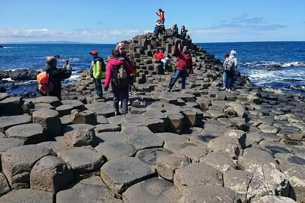
A full day at the Giant’s Causeway from Belfast, travelling the Causeway Coastal Route with your own local driver-guide and time for photos at every stop.
Giant’s Causeway Half Day Tour
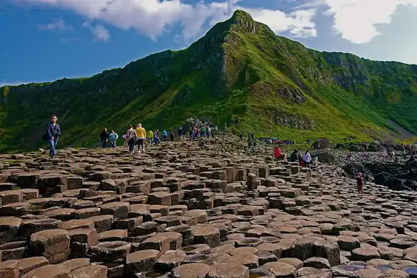
Short on time? A private half-day run to the Giant’s Causeway and the Antrim Coast, ideal if your day in Belfast is already busy.
Planning a private tour of Northern Ireland? ➔ Get in touch to discuss your ideas.
Connect with Us
We post from the north coast through the year on our social channels, from early mornings on the dunes at Runkerry to wild winter days at White Park Bay. It is a good way to see what the coast looks like in the month you are planning to visit.
If you have a question about Portballintrae, Portbraddan or anywhere else on the Causeway Coast, send us a message on any of the channels below. That is the quickest way to reach us, and we are happy to help whether or not you book a tour.
Facebook
Pinterest
LinkedIn
WhatsApp